The industry standard for a unified, data-driven approach to agricultural stewardship.
Everyone is watching.
We can self-regulate or wait for outsiders to do it for
us.

-
This is our moment.
We don’t have endless chances to get this right. - Joining the Mesonet network showcases your commitment to protecting the integrity of our industry to anyone who asks.
- That’s something to be proud of.
-
We must act today.
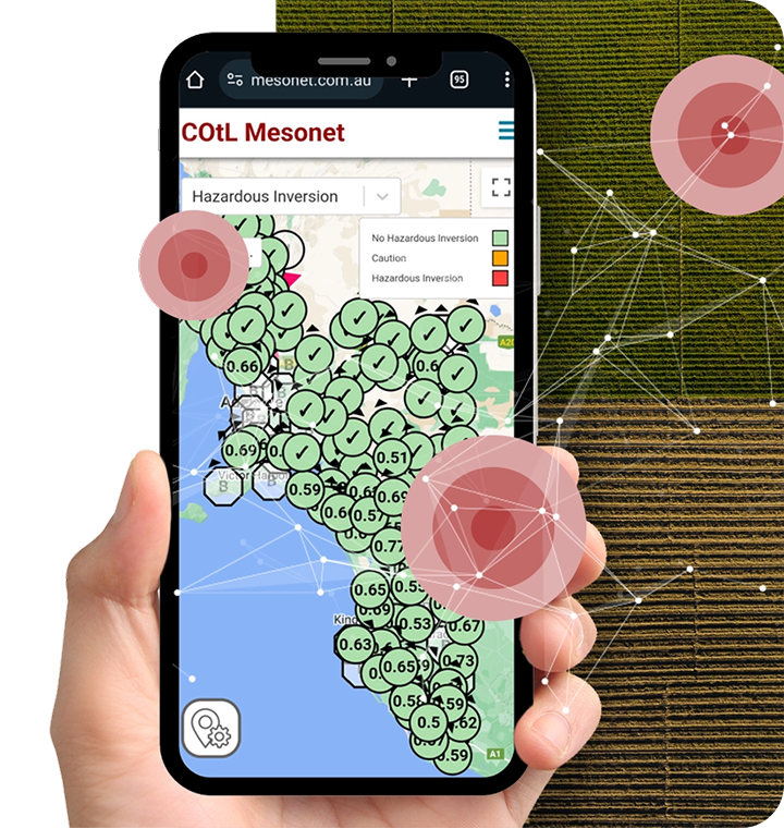
Backed by BoM-equivalent standards for atmospheric data accuracy and instrumentation quality, the Mesonet network is South Australia’s only hazardous inversion alert system, helping farmers:
-
Make informed spraying decisions to prevent drift and protect the community and markets

-
Prove compliance and stay ahead of regulatory changes

-
Unite as an industry to demonstrate professionalism, accountability and leadership
Stronger Together: The Mesonet Advantage
Australian farmers have consistently demonstrated innovation, resilience, and responsible land management practices. However, with increasing scrutiny on agricultural practices and growing regulatory pressures, the need for a unified, data-driven approach has never been greater.
Increasing regulation and public scrutiny means that every decision farmers make is examined. Activists, policymakers, and those outside the industry often lack an understanding of the science behind modern agriculture. But with Mesonet, farmers can:
-
Protect their practices

-
Take control of the conversation
-
Prove their expertise
Bottom line:
The more farmers who join the Mesonet network, the stronger the industry’s voice will be, and the easier it will be to maintain control over regulations and market access.
The industry standard is being set. Are you part of it?
Every farmer who joins makes the industry stronger.
Join the Mesonet network and optimise every decision. Real-time data with two-hour prediction at your fingertips – for just $1.50 a day.
Join today and take control of your farm’s future.
Best Value: Full Membership
=
instant access to all Mesonet network data.
Join the Mesonet network
Not Ready to Commit? Try the Mesonet network for FREE!
Better decisions start with better data.
Get FREE 14-day access to the Mesonet network and start using real-time climate and weather data to optimise your farm operations.
See why thousands of farmers worldwide use Mesonet networks to improve efficiency, reduce costs, and stay compliant - at no cost for two weeks!
Start your FREE trial today!
Sign up now!-
We invest in the Mesonet to enhance agricultural practices, benefiting the entire community.
Scott C -
The Mesonet is an essential, easy-to-use weather tool that helps us make precise spraying, spreading, and hay and harvesting decisions by eliminating guesswork and providing clear operational boundaries.
Roger H -
The Mesonet is an essential, enhanced weather tool that helps us make precise go-or-no-go decisions.
Graeme J -
Joining the Mesonet network showcases our industry’s commitment to stewardship and compliance with anyone who asks.
Damon G
Knowledge Hub:
Mesonet Insights
The weather doesn’t stop at your boundary line. Your data shouldn’t either

Coverage And Accuracy: The Mesonet Difference
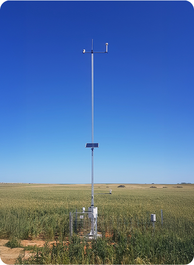
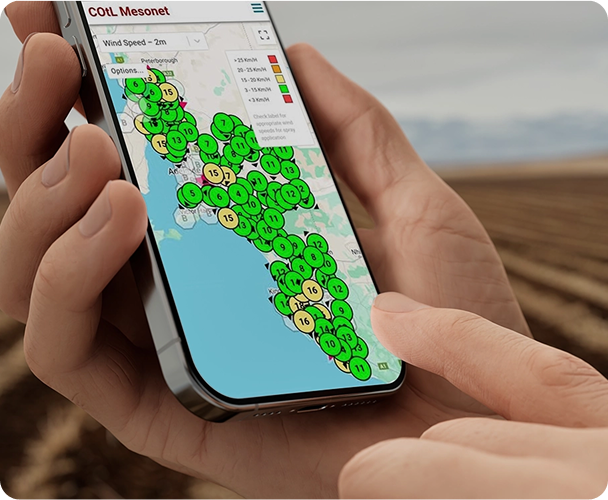
Spray drift is not just about what's happening on your farm - it’s about what’s happening around you. A regional Mesonet provides a network of high-density weather stations, delivering more precise, real-time atmospheric data across an entire region - not just a single farm. Unlike an on-farm weather station, which only captures local conditions at a single fixed point, a Mesonet enables farmers to see broader atmospheric trends that directly impact spray drift risk. Temperature inversions, shifting wind patterns, and humidity changes occur well beyond the farm boundary, affecting local spray decisions in ways an isolated weather station can’t detect. By joining the Mesonet network, farmers gain access to a complete, real-time regional picture, allowing them to anticipate drift risks more accurately, protect neighbouring farms and communities, and ensure compliance with best practices and regulations.

Market Access: Why Unification Matters
When farmers unify under the Mesonet network, it creates a consistent, transparent standard that simplifies complex evaluations by providing export markets with a single, verifiable data source. Rather than assessing a patchwork of disparate practices, international buyers and regulators can review uniform metrics that clearly demonstrate precision in chemical application, adherence to environmental standards, and commitment to best practices. This collective approach streamlines the evaluation process and significantly enhances credibility, as it reflects an industry-wide commitment to responsibility and innovation – demonstrating that Australian agriculture is modern, efficient, and fully aligned with global sustainability expectations.

Sustainable Agriculture: Powered By Climate Data
Beyond operational efficiency, the Mesonet supports a broader shift toward agricultural stewardship, where productivity, accountability, and sustainability are interlinked. This practical, data-driven approach aligns with six key United Nations Sustainable Development Goals (SDGs), not as a burden, but as a strategic opportunity. While the Mesonet’s benefits align with six of the United Nations' SDGs, this isn’t just about sustainability for its own sake. It’s about helping Australian farmers remain competitive in markets that increasingly demand transparency and stewardship across the supply chain. Mesonet enables farmers to demonstrate responsible agricultural practices - not just to meet rising standards, but to unlock access to premium markets, reduce operational costs, and protect long-term profitability. Choosing Mesonet isn’t just an operational upgrade - it’s a strategic investment in the future of your farm.
Mesonet was built for you, not because of you
Join the movement. Shield against misinformation
More safe spray hours. Less risk. Greater productivity. Only Mesonet separates hazardous from non-hazardous inversions - for just $1.50 a day.
Join today and take control of your farm’s future.
Mesonet benefits everyone
Mesonet provides the proof that regulators, markets, and the community are demanding, positioning Australian agriculture as:
- Proactive, not reactive.
- Innovative, not outdated.
- Responsible, not negligent.

This isn’t just a tool - it’s a statement. Australian farmers are professionals, and the Mesonet proves it.
One network. One standard. One voice.

 One network, one standard, one voice.

